
Spatial Data in the Semantic Web
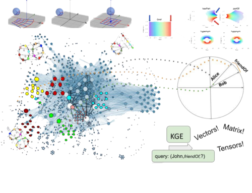
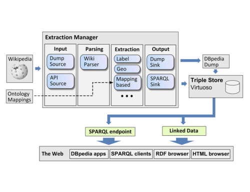
In order to employ the Web as a medium for data and information integration, comprehensive datasets and vocabularies are required as they enable the disambiguation and alignment of other data and information. Many real-life information integration and aggregation tasks are impossible without comprehensive background knowledge related to spatial features of the ways, structures and landscapes surrounding us. One of the central projects in this area is LinkedGeoData, in which data from OpenStreetMap is converted to RDF and linked to other knowledge bases. We designed a virtual mapping approach that allows to rewrite an incoming SPARQL query into a single SQL query potentially containing virtual spatial predicates. At that time, this was novel and allowed us to scale to a dataset with more than 30 billion facts, more than 1000 updates per minute and a semi-automatically generated ontology. Later on, in the GeoKnow EU project, we – together with other partners – build a landscape of tools to facilitate the entire life cycle of spatial data including the stages shown below.

Figure: The Linked Data Life Cycle implemented in the GeoKnow EU project (2012-2015)
Related Publications
Journal Articles
GeoKnow: Making the Web an Exploratory Place for Geospatial Knowledge Journal Article
In: ERCIM News, 2014 (96), 2014.
LinkedGeoData: A core for a web of spatial open data Journal Article
In: Semantic Web, 3 (4), pp. 333–354, 2012.
Incollections
Managing Geospatial Linked Data in the GeoKnow Project Incollection
In: The Semantic Web in Earth and Space Science. Current Status and Future Directions, 20 , pp. 51–78, IOS Press, 2015.
Inproceedings
GeoWINE: Geolocation based Wiki, Image, News and Event Retrieval Inproceedings
In: SIGIR '21: The 44th International ACM SIGIR Conference on Research and Development in Information Retrieval, Virtual Event, Canada, July 11-15, 2021, pp. 2565–2569, ACM, 2021.
Geolog: Scalable Logic Programming on Spatial Data Inproceedings
In: Proceedings 37th International Conference on Logic Programming (Technical Communications), ICLP Technical Communications 2021, Porto (virtual event), 20-27th September 2021, pp. 191–204, 2021.
Big POI data integration with Linked Data technologies Inproceedings
In: Advances in Database Technology - 22nd International Conference on Extending Database Technology, EDBT 2019, Lisbon, Portugal, March 26-29, 2019, pp. 477–488, OpenProceedings.org, 2019.
Clustering Pipelines of Large RDF POI Data Inproceedings
In: The Semantic Web: ESWC 2019 Satellite Events - ESWC 2019 Satellite Events, Portorož, Slovenia, June 2-6, 2019, Revised Selected Papers, pp. 24–27, Springer, 2019.
LinkedGeoData: Adding a Spatial Dimension to the Web of Data Inproceedings
In: The Semantic Web - ISWC 2009, 8th International Semantic Web Conference, ISWC 2009, Chantilly, VA, USA, October 25-29, 2009. Proceedings, pp. 731–746, Springer, 2009.
